The Centrale Stichting Wederopbouw (Central Foundation for Re-construction, CSW) coordinated and supervised the technicalities and finances of the Dutch East Indian government reconstruction efforts in areas once again brought under Dutch control after Indonesia had proclaimed its independence. Kebayoran Baru was the first urban plan CSW initiated. It was also the first urban plan that bears the signature of a former assistant of renowned Dutch East Indian architect Thomas Karsten, the Indonesian architect Mohamed Soesilo (1899-1993).
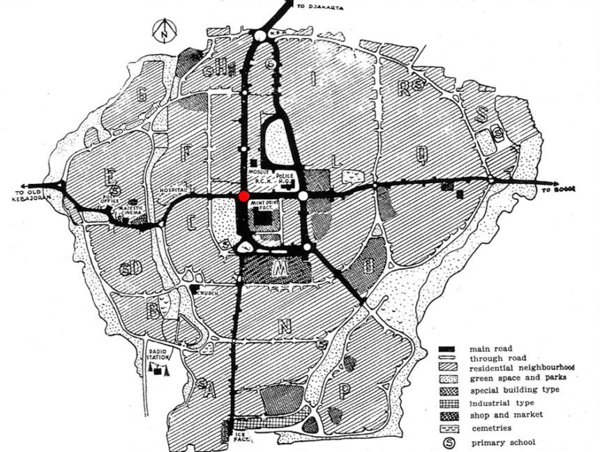
Kebayoran Baru was developed to alleviate the dire shortage of housing in post-war Batavia/Jakarta. Conceived as a so-called ‘new town’, it was an entirely new settlement situated at such a distance from an existing town that it was hoped it would dissuade daily commutes between the old and new settlements. The surroundings of Depok were initially chosen as the site for Indonesia’s first post-war new town. However, due to the ongoing hostilities between colonial and republican armies at the time, it soon became apparent that the Dutch government couldn’t guarantee the safety of people near Depok, so Soesilo and his colleagues at the Central Planning Bureau reconsidered and opted for Kebayoran, a settlement much closer to Batavia/Jakarta than Depok.
Despite Kebayoran’s proximity to Batavia/Jakarta, its advantages over Depok were clear. It was connected to Batavia/Jakarta by railway, its population density was low, its terrain was extremely suitable for building, and two nearby rivers facilitated water drainage. These pragmatic considerations, in conjunction the terrain’s elevated, and somewhat eery outline, offered great opportunities for panoramic and idyllic views convinced the Central Planning Bureau Kebayoran was an excellent location to build their new town.